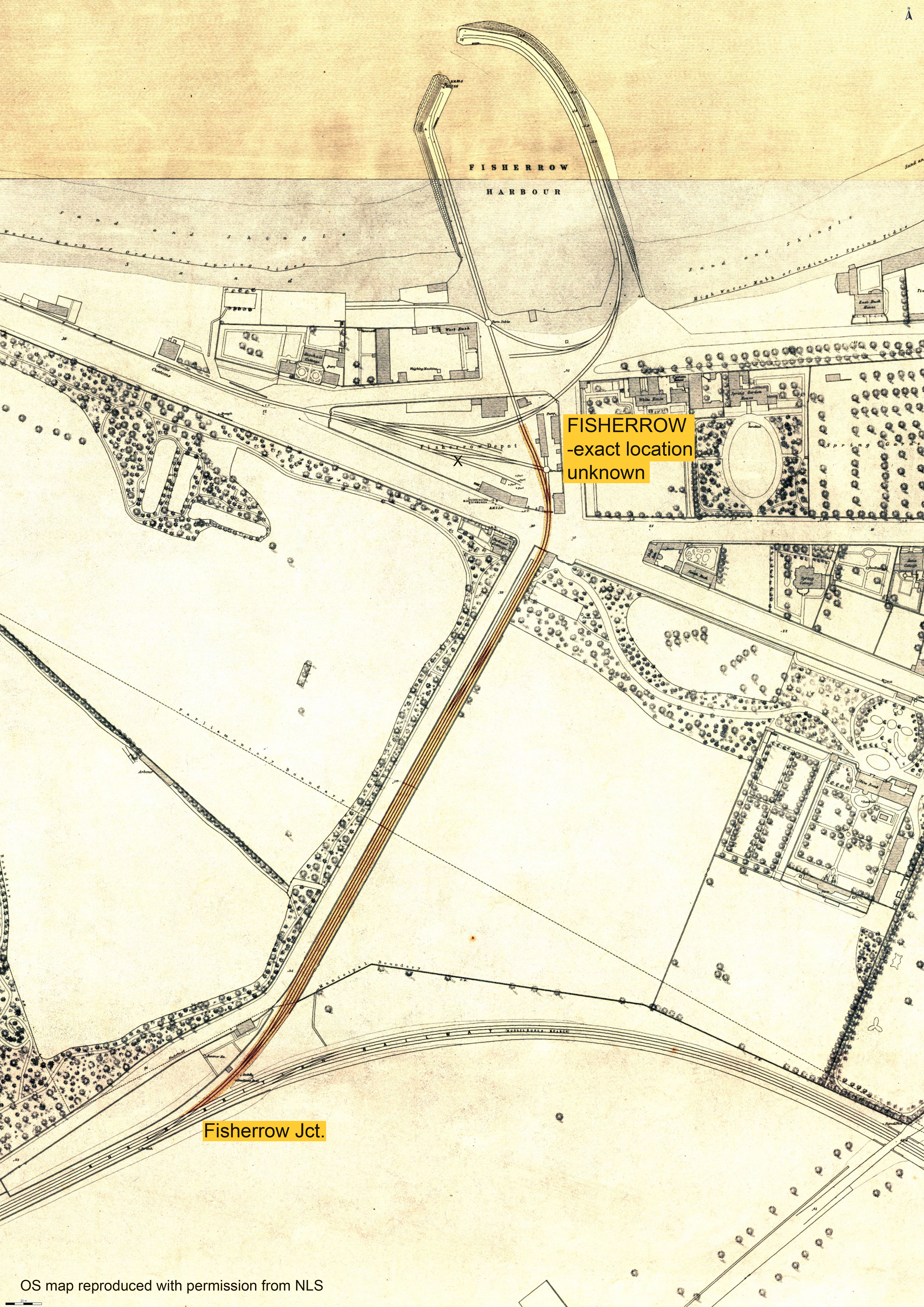
Fisherrow Jct. - Fisherrow [Musselburgh]
Date Closed to Passenger Services
14 Jul 1847
Mileage Closed
0m 23c†
Stations Closed
Fisherrow
Cobb Atlas Reference
545 32 72 - 546 33 72; NT 33245 72539 - NT 33444 72914
Present Status
Dismantled
Map

Further Notes
ACD - Wed 14/07/1847 - CPLGB p59. C; DRS give 15/07/1847. RPSGB states "replaced by Musselburgh, which op 14 July 1847 but perhaps actually clo 1 February 1847". British Railways Stations 1825-1900 also gives 01/02/1847.
The exact location of Fisherrow station (or depot), such as it probably was, is difficult to pinpoint. As with most early horse-drawn railways, stations were often non-existent as such and were little more than stopping places with few, if any, facilities. British Railways Stations 1825-1900 suggests the station was located to the west of the 'main line' (X on the map). As that map is dated 1893, it would appear that the track layout had changed considerably from the time of the passenger service, as the S-W curve shown is not evident on the 1853 map used here. It is likely that the horse-drawn carriages stopped wherever it was convenient.
This is all, of course, conjecture and I am happy to be corrected!
Page updated: 07/01/2024