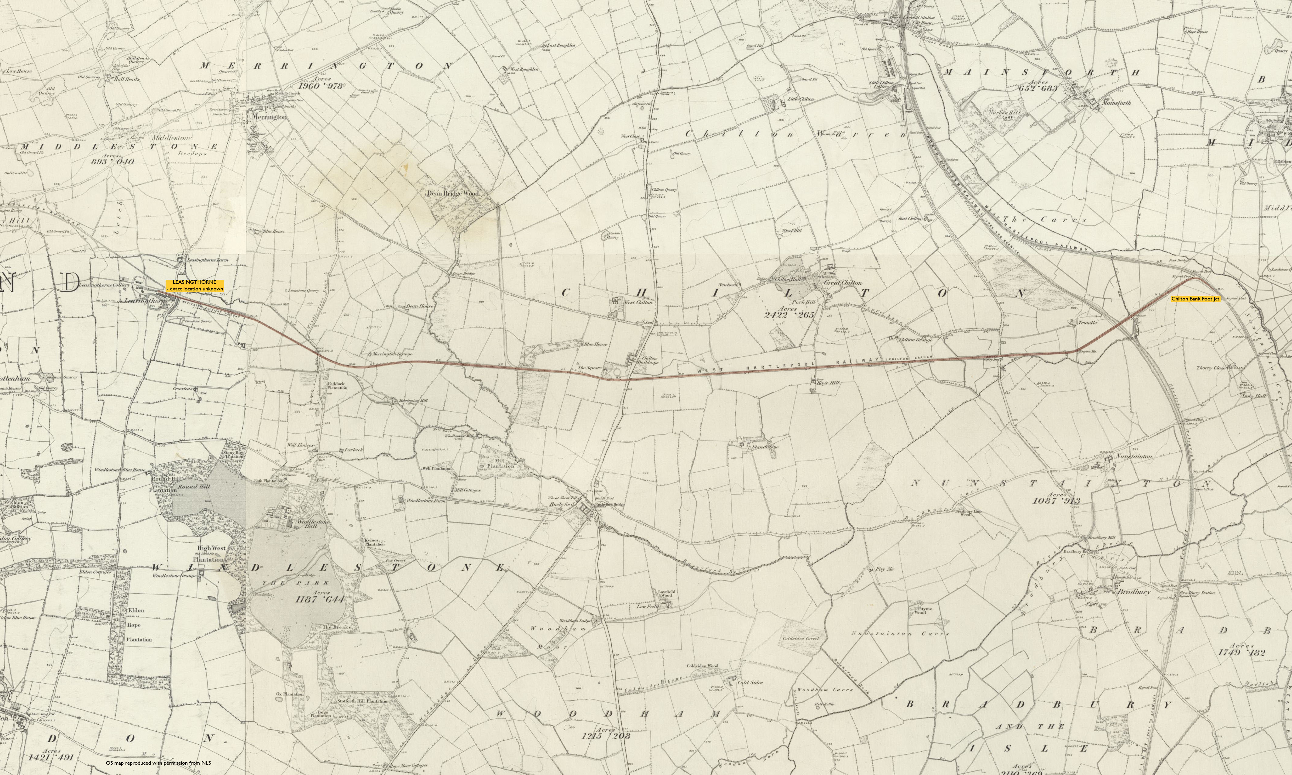
Chilton Bank Foot Jct. - Leasingthorne
Date Closed to Passenger Services
Apr 1867
Mileage Closed
4m 17c*
Stations Closed
Leasingthorne
Cobb Atlas Reference
448 32 30 - 25 30; NZ 32440 30173 - NZ 25550 30163
Present Status
Dismantled
Map
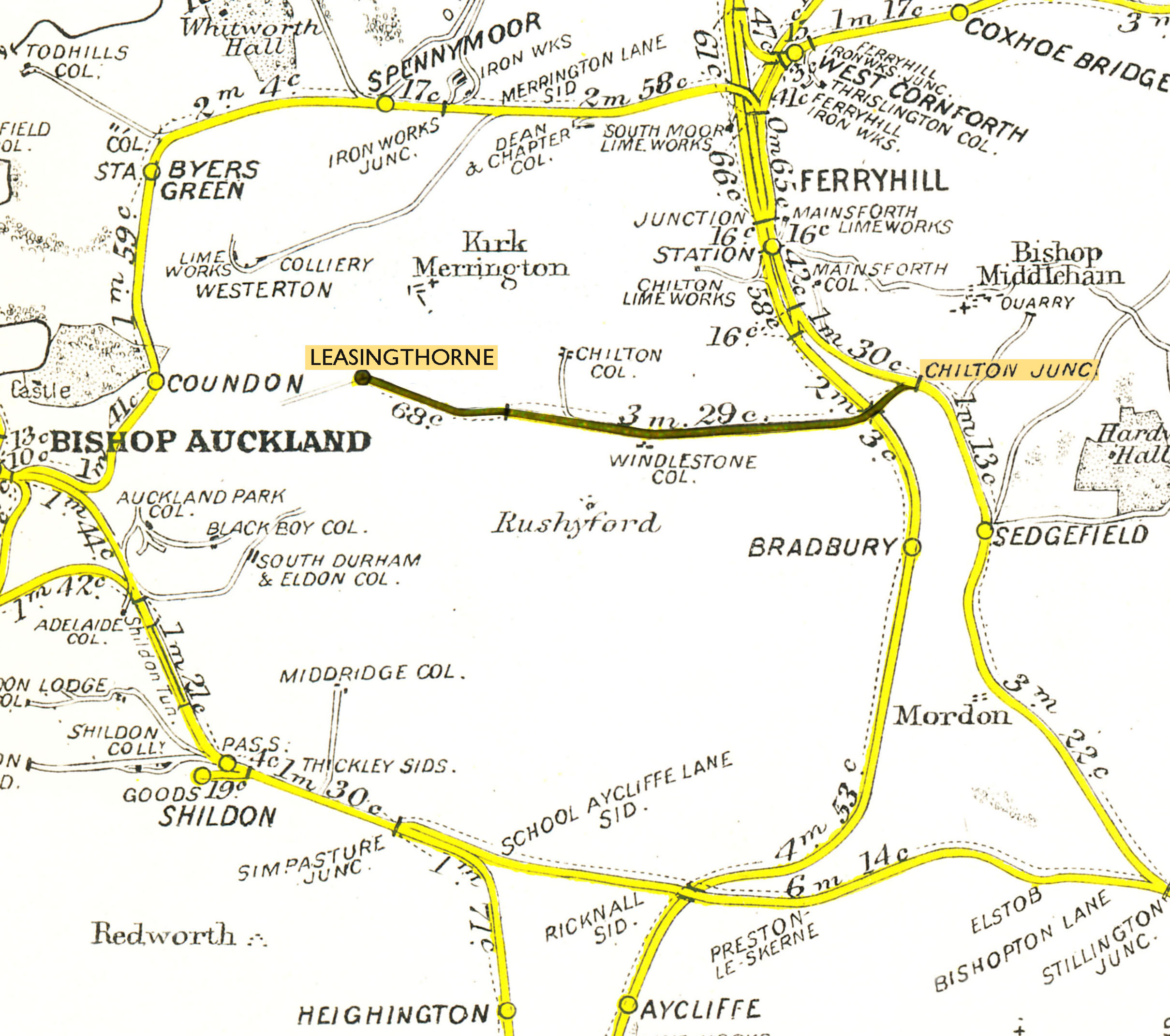 RCH D&N 1922
Further Notes
ACD - ?/04/1867 - CPLGB p19; RPSGB.
There is conflicting information concerning the name of the terminus station, Leasingthorne or Westerton. C, CPLGB and RPSGB record it as Leasingthorne, though RPSGB states "map evidence suggests Westerton was different site", (assuming reference to another station, unlikely given settlement of that name is roughly 1 mile NW of Leasingthorne). DRS records Westerton only. Cobb shows Westerton at time of closure to passengers and subsequently Leasingthorne when open to goods traffic only from 1890. RR NE343 supports this, stating Leasingthorne "Westerton until 1890".
*RCH D&N 1922. RR NE343 gives 3m 28c. OS map measuring tool confirms the former as the more accurate.
Page updated: 21/02/2024