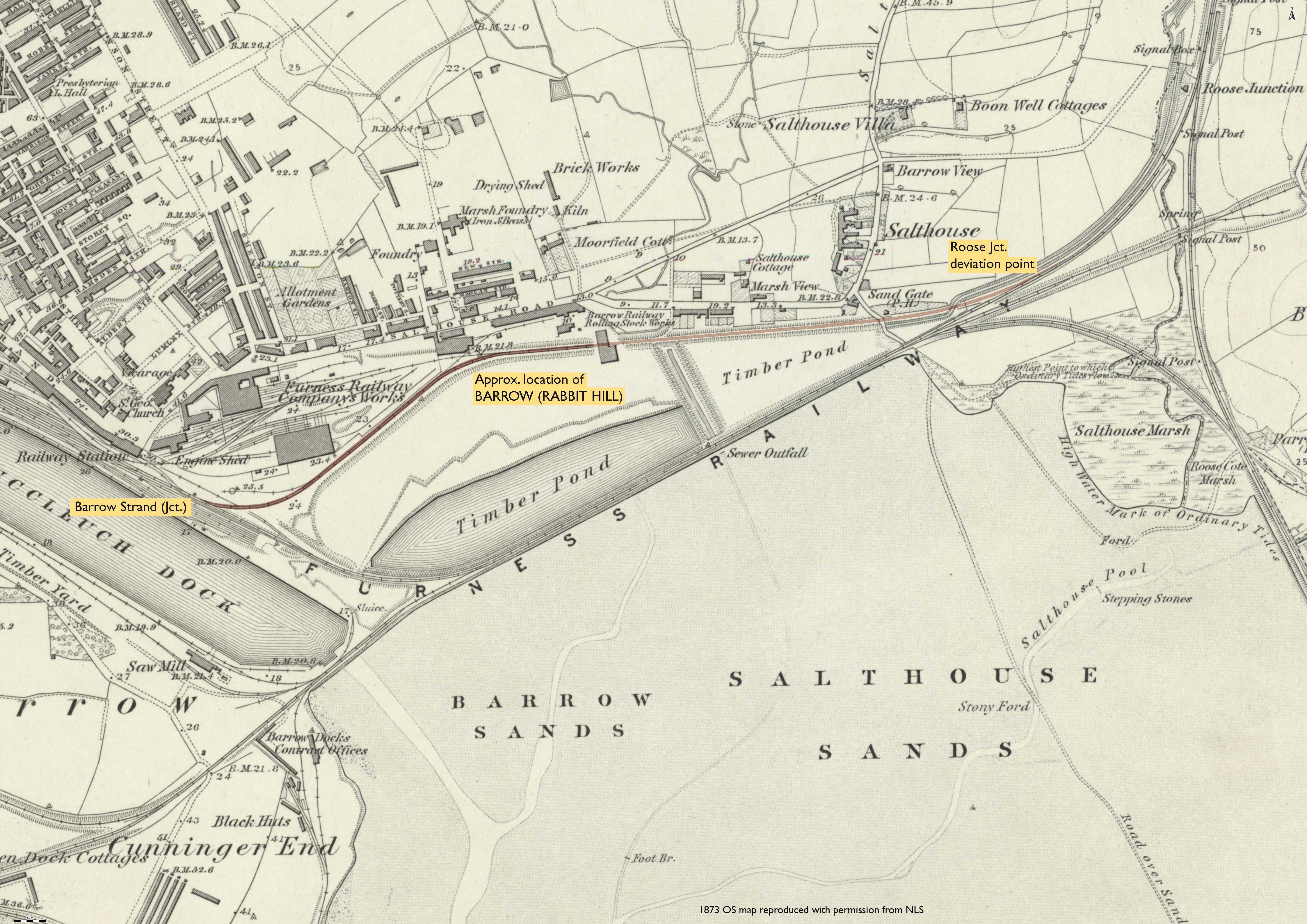
Roose Jct. (deviation point) - Barrow (Strand) (Jct.)
Date Closed to Passenger Services
Jan 1871
Mileage Closed
0m 75c*
Stations Closed
Barrow (Rabbit Hill) (06/05/1863)**
Cobb Atlas Reference
405 22 69 - 19 68; SD 21713 68904 - SD 20348 68569
Present Status
Dismantled
Map
Further Notes
ACD - 1871, exact date unknown. CPLGB p22 gives c.01/1871. Replaced by new line to S from Roose Jct. via Buccleuch Jct.
*Mileage calculated using OS map measuring tool.
**Barrow (Rabbit Hill) was the original terminus, being closed on the extension of the line to Barrow (Strand). The exact location of Rabbit Hill station is uncertain. Cobb shows the extension to Strand as a through line. The Furness Railway OL35 OP 1978 p23 map shows the extension deviating to E of Rabbit Hill station looping S towards Strand. The accompanying map on this webpage would tend to support this.
Page updated: 28/02/2024