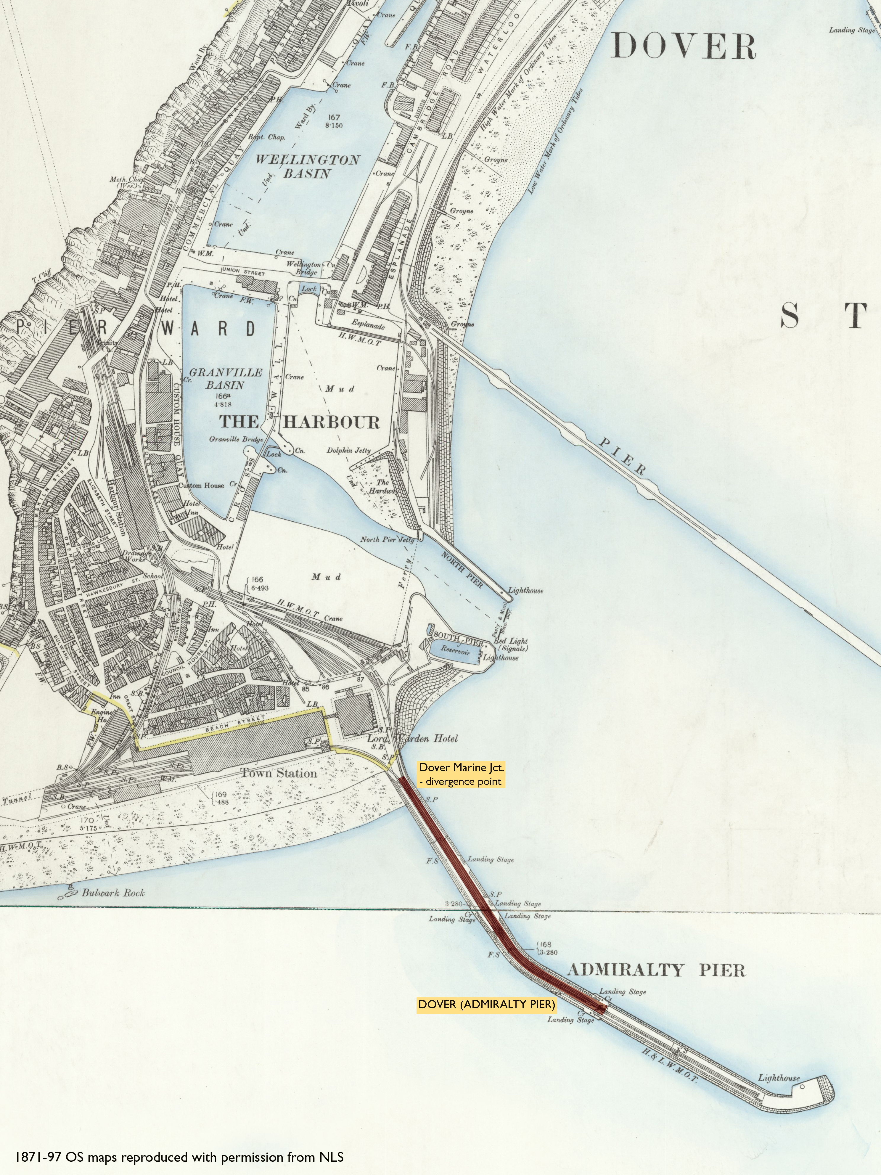
Dover Marine Jct. (divergence point) - Dover (Admiralty Pier)
Date Closed to Passenger Services
Aug 1914
Mileage Closed
0m 17c*
Stations Closed
Services Operated
Charing Cross/Victoria - Dover (Admiralty Pier)
Timetable Reference
B921 Apr 1910 228 & 234
Cobb Atlas Reference
92 31 40 - 32 39; TR 320403 - TR 322400
Present Status
Dismantled
Map
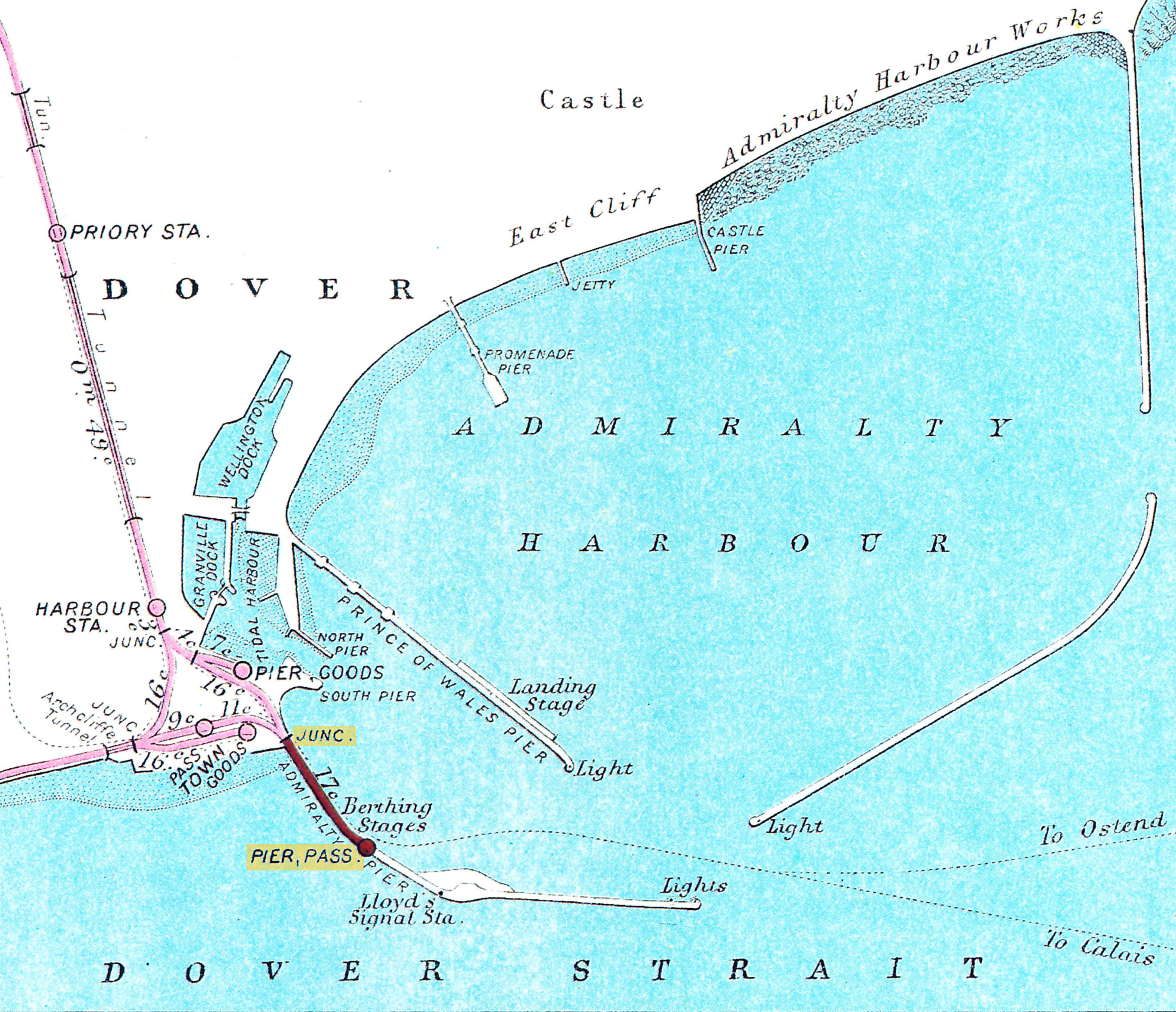 RCH RJD 33 1908
Further Notes
ACD needs confirmation. Records show Aug 1914 only. Replaced by newly-constructed Marine station, the changeover being interrupted and delayed by the outbreak of war in Aug 1914.
Further information welcome.
In terms of the "line of route" definition, the inclusion of this as a section of line is debatable. Essentially, Dover Marine was constructed partly on the site of Admiralty Pier, but mostly on land reclaimed to the east side. However, the respective track alignments were different. The site of Dover Marine Jct. appears to be roughly on the site of the original junction shown on the RCH RJD 33 1908 map, hence I have used that as the divergence point.
Whatever the pros and cons, I have included it here for the record, as other publications have done.
Page updated: 28/12/2024