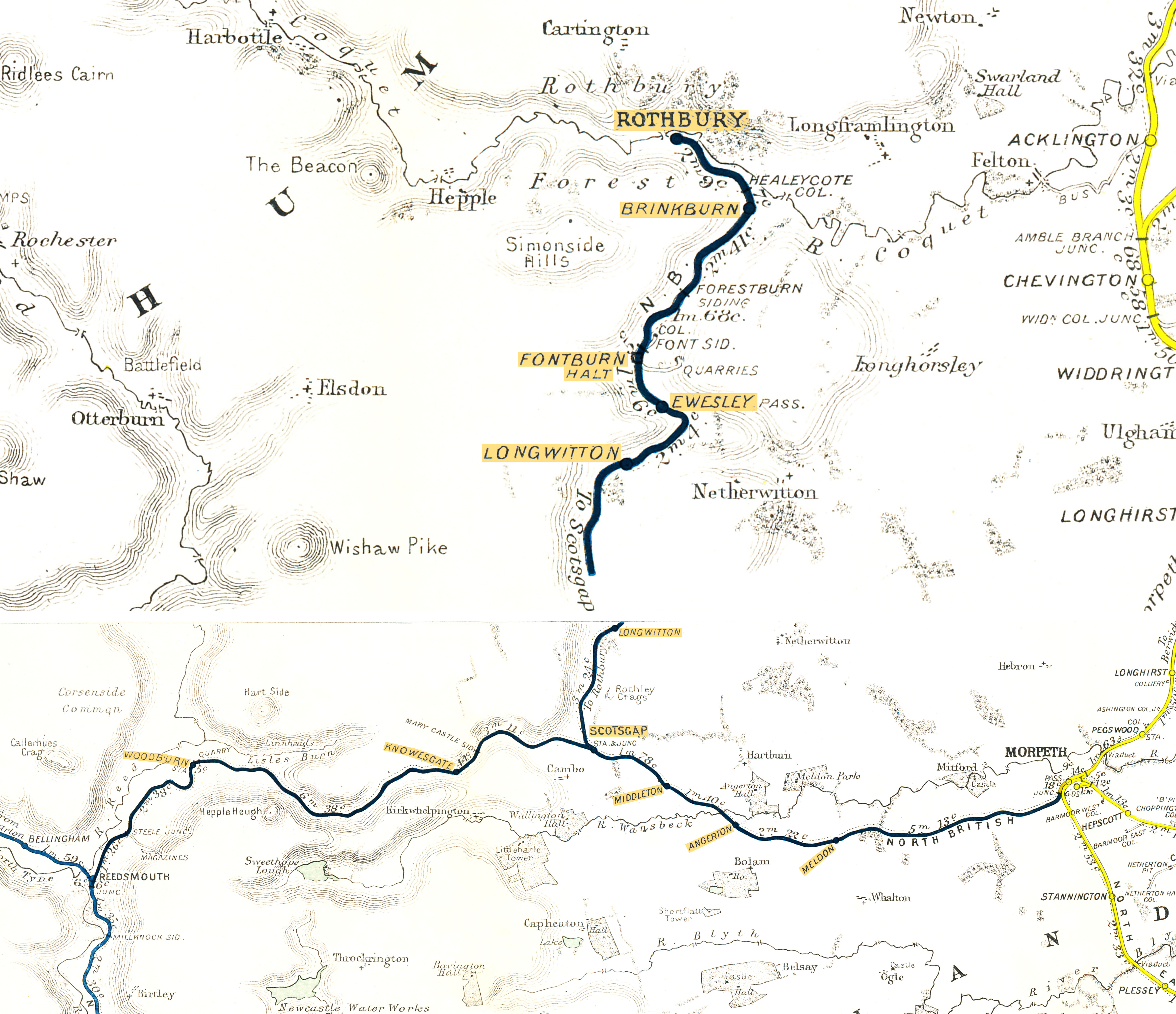
Reedsmouth (Jct.) - Morpeth (excl.); Scotsgap Jct. (divergence point)** - Rothbury
Date Closed to Passenger Services
15 Sep 1952
Mileage Closed
38m 21c*
Stations Closed
Woodburn; Knowesgate; Scotsgap****; Middleton North; Angerton; Meldon
Services Operated
Reedsmouth - Scotsgap***
Rothbury- Scotsgap - Morpeth
Timetable Reference
B1416 Sep 1951 925
Cobb Atlas Reference
486 86 82 - 487 20 85; 487 03 86 - 501 06 01
Present Status
Dismantled
Map
 RCH Durham & Northumberland Districts 1922
Further Notes
ACD - Mon 15/09/1952 - PNM 1980 p67. No Sunday service, LTR - Sat 13/09/1952.
*RCH D 1922. Reedsmouth (Jct.) - Morpeth (excl.) - 25m 19c; Scotsgap Jct.** - Rothbury - 13m 2c.
**Scotsgap Jct. was in reality the divergence point of the Rothbury branch from the the line to Reedsmouth Junction. The physical junction connection was at Scotsgap station, approximately 17c to the east.
Services to Rothbury operated from a dedicated branch platform at Morpeth (an island platform with the northbound mainline services). The actual junction connection with the mainline was to the north of the station. The 'Junc.' shown on the RCH map to the south was an end-on junction marking the boundary between the NBR and the NER.
Apologies for the disjointed nature of this map. The Northumberland section north of Newcastle is shown in a separate inset and is on a smaller scale to the main map. I have enlarged this section to approximately match the scale of the main section.
*** 4 15pm Reedsmouth - Scotsgap started from Bellingham (North Tyne) at 4 5pm.
**** Scotsgap was the spelling as it appeared in the TT from B847 Feb 1904 (possibly earlier) until closure. B Aug 1887 and NBR WTT for Oct 1899 show Scots Gap Junc. Earlier references included Scot's Gap. The B.R. TT for June 1951 Table 76 shows Scotsgap (for Cambo). A c1930 photograph shows the station nameboard worded SCOTSGAP JUNCTION, whilst one taken c1950 reads SCOTSGAP Jct. The signalbox nameboard read SCOTSGAP JUNCTION and was located at the station, whilst the OS map for 1902 shows the wording Scots' Gap Junction adjacent to the point of divergence and Scots' Gap adjacent to the station. See The Rothbury Branch LP180 OP 1991. A rival for Lakeside as the contender for the most nomenclature variations!
Page updated: 10/12/2024